Category:Melton, East Riding of Yorkshire
Jump to navigation
Jump to search
English: Melton is a village in the civil parish of Welton in East Riding of Yorkshire, England. It is situated about 8 miles (13 km) west of Kingston upon Hull city centre and lies to the north of the A63 road.
village in the civil parish of Welton, East Riding of Yorkshire, England  Melton (2008) | |||||
| Upload media | |||||
| Instance of | |||||
|---|---|---|---|---|---|
| Location | Welton, East Riding of Yorkshire, Yorkshire and the Humber, England | ||||
 | |||||
Subcategories
This category has the following 13 subcategories, out of 13 total.
C
- Capper Pass, Melton (6 F)
M
- Melton Halt railway station (3 F)
- Melton level crossing (10 F)
R
- Redcliff Middle Sand (17 F)
- Redcliff Sand (14 F)
- Redcliff, Humber Estuary (24 F)
T
- Terrace Plantation (14 F)
Media in category "Melton, East Riding of Yorkshire"
The following 176 files are in this category, out of 176 total.
-
 'Temporary' housing at Melton (geograph 5325773).jpg 800 × 600; 69 KB
-
 A glimpse of the Humber (geograph 3898321).jpg 1,024 × 768; 238 KB
-
 A Humber Tug - geograph.org.uk - 247499.jpg 640 × 480; 104 KB
-
 A Narrow Path - geograph.org.uk - 247515.jpg 640 × 480; 108 KB
-
 A snake of daffodils (geograph 5326049).jpg 600 × 800; 165 KB
-
 A very wet A63 dual carriageway at Melton (geograph 5326045).jpg 800 × 600; 96 KB
-
 A wet frog attracts interest at Melton West Business Park (geograph 5318668).jpg 5,376 × 3,024; 1.87 MB
-

-
 A63 eastbound at Melton (geograph 5254433).jpg 640 × 511; 63 KB
-
 A63 overbridge, Melton (geograph 3808397).jpg 1,920 × 1,174; 342 KB
-
 A63 towards Hull - geograph.org.uk - 1604689.jpg 640 × 480; 62 KB
-
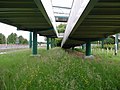
 A63 Underpass, Melton - geograph.org.uk - 901034.jpg 640 × 443; 62 KB
-
 A63 westbound (geograph 5658077).jpg 640 × 480; 46 KB
-
 A63, Melton - geograph.org.uk - 584121.jpg 640 × 440; 165 KB
-
 Across the Humber - geograph.org.uk - 710333.jpg 640 × 480; 183 KB
-
 And Look At Where We've Been - geograph.org.uk - 247502.jpg 640 × 480; 104 KB
-
 Between A63 and the Humber - geograph.org.uk - 1353235.jpg 640 × 420; 339 KB
-

-
 Boundary wall, Melton Bottom (geograph 3898299).jpg 1,024 × 768; 204 KB
-
 Bow Lane towards Melton Bottom (geograph 5251570).jpg 1,200 × 799; 426 KB
-
 Bow Road at Melton Bottom (geograph 4102513).jpg 1,600 × 1,064; 642 KB
-
 Brickyard Lane (geograph 4343106).jpg 4,000 × 2,248; 6.51 MB
-
 Brickyard Lane (geograph 4480977).jpg 1,024 × 768; 314 KB
-
 Brickyard Lane - geograph.org.uk - 1353246.jpg 640 × 427; 335 KB
-
 Brickyard Lane - geograph.org.uk - 529122.jpg 640 × 481; 158 KB
-
 Brickyard Lane - geograph.org.uk - 529996.jpg 640 × 453; 137 KB
-
 Brickyard Lane blocked (geograph 5317823).jpg 3,072 × 1,728; 2.49 MB
-
 Brickyard Lane ends - geograph.org.uk - 1462077.jpg 640 × 480; 75 KB
-
 Brickyard Lane fields - geograph.org.uk - 710239.jpg 640 × 447; 182 KB
-

-
 Brickyard Lane, Melton - geograph.org.uk - 444178.jpg 473 × 640; 119 KB
-
 Bridge HUL1-21 - geograph.org.uk - 528867.jpg 640 × 480; 113 KB
-

-
 Change in direction (geograph 4137807).jpg 1,024 × 768; 302 KB
-
 Channel Buoy 29 - geograph.org.uk - 225833.jpg 480 × 640; 104 KB
-
 Clearway lorries at Melton Bottom (geograph 5251645).jpg 1,200 × 799; 535 KB
-
 Close up, George V postbox on Gibson Lane North, Melton (geograph 5658787).jpg 1,129 × 2,000; 545 KB
-
 Conveyor belt at Hodge Clemco plant (geograph 4137823).jpg 1,024 × 768; 140 KB
-
 Crumbling Red Cliff on the Humber Bank (geograph 4976042).jpg 640 × 427; 56 KB
-
-
 Cutting west of Melton Bridge (geograph 4549920).jpg 640 × 325; 77 KB
-
 Cutting west of North Ferriby (geograph 4540759).jpg 640 × 426; 60 KB
-
 Cutting west of North Ferriby (geograph 4540760).jpg 640 × 426; 93 KB
-
 Derelict Building at Low Field Farm - geograph.org.uk - 530017.jpg 640 × 481; 131 KB
-
 Disused storage tanks off Gibson Lane (geograph 4137828).jpg 1,024 × 768; 180 KB
-
 Double crossing, by the Humber (geograph 6438828).jpg 683 × 1,024; 1.08 MB
-
 East Clough (geograph 7088673).jpg 768 × 1,024; 190 KB
-
 East Clough foreshore - geograph.org.uk - 710294.jpg 640 × 480; 201 KB
-
 East Clough, near Melton (geograph 6438822).jpg 1,024 × 683; 790 KB
-
 East of Brickyard Lane - geograph.org.uk - 529147.jpg 640 × 426; 128 KB
-
 Farmland - geograph.org.uk - 130192.jpg 640 × 480; 112 KB
-
 Farmland off Melton Bottom - geograph.org.uk - 1733627.jpg 800 × 600; 157 KB
-
 Farmland towards the River Humber (geograph 5658042).jpg 640 × 480; 68 KB
-
 Field near Melton (geograph 5665967).jpg 640 × 480; 60 KB
-
 Field next to Melton Crossing - geograph.org.uk - 243329.jpg 640 × 479; 57 KB
-
 Finger post at Bow Plantation, Melton Bottom (geograph 4102521).jpg 1,600 × 1,064; 1.03 MB
-
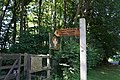 Finger post at Terrace Plantation (geograph 4102503).jpg 1,600 × 1,064; 839 KB
-
 Foot bridge over the A63, Melton (geograph 5658071).jpg 640 × 480; 52 KB
-
 Footbridge (and Cycleway) over A63 - geograph.org.uk - 1604683.jpg 640 × 480; 73 KB
-
 Footpath to West Clough (geograph 4137816).jpg 768 × 1,024; 282 KB
-
 Foreshore near North Ferriby (geograph 7155649).jpg 1,024 × 768; 1.41 MB
-
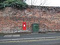 George V postbox on Gibson Lane North, Melton (geograph 5658786).jpg 2,848 × 2,136; 1.23 MB
-
 Gibson Lane - geograph.org.uk - 243324.jpg 640 × 480; 125 KB
-
 Gibson Lane cottages, Melton - geograph.org.uk - 710185.jpg 640 × 480; 169 KB
-
 Gibson Lane North, Melton (geograph 5658789).jpg 2,848 × 2,136; 1.19 MB
-
 Gibson Lane, Melton (geograph 4609104).jpg 1,200 × 818; 324 KB
-
 Gibson Lane, Melton - geograph.org.uk - 900222.jpg 640 × 482; 95 KB
-
 Great Gutter Lane - geograph.org.uk - 1324998.jpg 640 × 427; 391 KB
-
 Holly and the Humber (geograph 5699361).jpg 1,024 × 768; 170 KB
-
 House of Townend on Wyke Way, Melton (geograph 4607756).jpg 1,200 × 799; 300 KB
-
 House of Townend Wine Merchants, Melton (geograph 5658060).jpg 640 × 449; 45 KB
-
 Houses on Gibson Lane South, Melton (geograph 5658063).jpg 640 × 480; 71 KB
-
 Humber Bank - geograph.org.uk - 533456.jpg 640 × 432; 103 KB
-
 Humber foreshore beside Melton Ings (geograph 4343093).jpg 3,980 × 2,212; 5.72 MB
-
 Humber foreshore near North Ferriby (geograph 5665955).jpg 640 × 480; 98 KB
-
 Humber Shoreline - geograph.org.uk - 775415.jpg 640 × 307; 110 KB
-
 Humber Sloop off South Ferriby Sluice (geograph 5891780).jpg 1,024 × 878; 194 KB
-
 Industrial area near Gibson Lane - geograph.org.uk - 1462107.jpg 640 × 450; 51 KB
-
 Industrial building, Melton (geograph 4549927).jpg 640 × 401; 44 KB
-
 Industrial estate (geograph 4480989).jpg 1,024 × 768; 96 KB
-
 Isolated building (geograph 4549930).jpg 640 × 426; 51 KB
-
 Lone tree, near Melton (geograph 6438820).jpg 1,024 × 1,024; 1.45 MB
-
 Long Plantation - geograph.org.uk - 1604753.jpg 640 × 480; 65 KB
-
 Looking across the Humber at West Clough (geograph 4343084).jpg 3,978 × 2,206; 6.51 MB
-
 Looking towards Long Plantation (geograph 3898314).jpg 1,024 × 768; 149 KB
-
 Low Field Lane (geograph 7157797).jpg 4,928 × 3,436; 3.96 MB
-
 Low Field Lane - geograph.org.uk - 530007.jpg 640 × 424; 99 KB
-
 Melton Bridge, Brickyard Lane - geograph.org.uk - 1604774.jpg 640 × 480; 56 KB
-
 Melton footbridge.jpg 640 × 597; 207 KB
-
 Melton Junction - geograph.org.uk - 901039.jpg 498 × 640; 96 KB
-
 Melton Pond (geograph 5972684).jpg 1,024 × 768; 340 KB
-
 Melton railway bridge carrying Brickyard Lane (geograph 4480982).jpg 1,024 × 551; 108 KB
-
 Melton Road goes over the A63 near Melton (geograph 4102379).jpg 1,600 × 1,064; 726 KB
-
 Melton Road towards the A63 (geograph 4102315).jpg 1,600 × 1,064; 656 KB
-
 Melton subway (geograph 4342177).jpg 577 × 640; 197 KB
-
 Melton to Ferriby foreshore - geograph.org.uk - 457703.jpg 640 × 480; 126 KB
-
 Melton underpass - geograph.org.uk - 584105.jpg 640 × 415; 159 KB
-
 Muddy Waters - geograph.org.uk - 247501.jpg 640 × 480; 105 KB
-
 National Cycle Route 65, Melton (geograph 5658053).jpg 640 × 480; 57 KB
-
 New Roundabout - geograph.org.uk - 529976.jpg 640 × 480; 81 KB
-
 No through road on Brickyard Lane (geograph 5325753).jpg 800 × 600; 188 KB
-
-
 North Hull Scout campsite - geograph.org.uk - 584168.jpg 640 × 480; 187 KB
-
 North Hull scouts campsite. (geograph 6153109).jpg 1,024 × 683; 335 KB
-
 Old bungalows on Gibson Lane, Melton (geograph 5318333).jpg 5,376 × 3,024; 2.57 MB
-
 Old Rd Melton - panoramio.jpg 1,400 × 933; 769 KB
-
 On top of the Red Cliff (geograph 3898325).jpg 1,024 × 768; 136 KB
-
 On track to Sheffield (geograph 6059887).jpg 4,608 × 3,456; 3.92 MB
-
 Out Of The Wood - geograph.org.uk - 247516.jpg 640 × 480; 108 KB
-
 Passenger train approaching Melton Crossing (geograph 4976109).jpg 640 × 427; 46 KB
-
 Path alongside the Humber (geograph 7088669).jpg 1,024 × 768; 135 KB
-
 Pedestrian bridge across A63 at Melton (geograph 5318370).jpg 5,376 × 3,024; 2.02 MB
-
 Pink frog at Melton Grange (geograph 5326040).jpg 800 × 600; 154 KB
-
 Public footpath for skinny people (geograph 4976884).jpg 640 × 427; 87 KB
-
 Rail footbridge, North Ferriby - geograph.org.uk - 584062.jpg 480 × 640; 199 KB
-

-
 Railway Line towards Hull - geograph.org.uk - 1604780.jpg 640 × 480; 83 KB
-
 Railway towards York and Doncaster (geograph 5658026).jpg 640 × 480; 63 KB
-
 Red Cliff (geograph 4343110).jpg 3,964 × 2,180; 5.77 MB
-
 Red Cliff, on the north bank of the Humber (geograph 4664316).jpg 1,024 × 768; 166 KB
-
 Redcliff and the Humber from East Clough (geograph 4976033).jpg 640 × 427; 53 KB
-
 Redcliff Channel - geograph.org.uk - 1604721.jpg 640 × 480; 62 KB
-
 Redcliff Channel - geograph.org.uk - 1604737.jpg 640 × 479; 55 KB
-
 Redcliff Middle Sand - geograph.org.uk - 833430.jpg 640 × 427; 48 KB
-
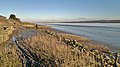
 River Humber near Melton (geograph 5665961).jpg 640 × 480; 88 KB
-
 Rough and ready^ - geograph.org.uk - 710148.jpg 640 × 480; 180 KB
-
 Rusting Bridge - geograph.org.uk - 247513.jpg 640 × 480; 109 KB
-
 Sidings at Melton (geograph 4549932).jpg 640 × 426; 57 KB
-
 Start of green lane footpath (geograph 5978787).jpg 1,024 × 768; 289 KB
-
 Static homes (geograph 4549923).jpg 640 × 370; 52 KB
-
 Static homes storage (geograph 4549925).jpg 640 × 374; 54 KB
-
 Steps down at West Clough (geograph 4137760).jpg 1,024 × 768; 250 KB
-
 Storage of static homes (geograph 4549926).jpg 640 × 426; 46 KB
-
 Swing by the Humber (geograph 7155655).jpg 683 × 1,024; 1.51 MB
-
 Terrace Plantation, Melton Hill - geograph.org.uk - 280392.jpg 432 × 640; 134 KB
-
 The (Yorkshire) Wolds Way - geograph.org.uk - 1324990.jpg 427 × 640; 403 KB
-
 The Humber Floodbank - geograph.org.uk - 775411.jpg 640 × 480; 259 KB
-

-
 The Humber foreshore at West Clough (geograph 5325759).jpg 800 × 600; 114 KB
-
 The Line towards Brough - geograph.org.uk - 529260.jpg 640 × 426; 150 KB
-
 The Magenta Toad (geograph 4605206).jpg 1,600 × 1,065; 767 KB
-
 The Magenta Toad (geograph 4605213).jpg 1,600 × 1,065; 704 KB
-

-
 The Old Farmhouse (geograph 5326052).jpg 800 × 600; 88 KB
-
 The outfall of Common Drain (geograph 4137765).jpg 1,024 × 768; 167 KB
-
 The pier that disappeared! (geograph 4343099).jpg 3,986 × 2,222; 5.72 MB
-
 The River Humber at Redcliff, on a falling tide (geograph 5613601).jpg 1,024 × 768; 113 KB
-
 The Track to Brough (geograph 3316513).jpg 3,648 × 2,736; 2.87 MB
-
 The Trans-Pennine Trail - geograph.org.uk - 247482.jpg 640 × 480; 100 KB
-
 The Trans-Pennine Trail - geograph.org.uk - 688794.jpg 640 × 480; 117 KB
-
 The Trans-Pennine Trail west of Hessle - geograph.org.uk - 775414.jpg 640 × 394; 220 KB
-
 The Wolds Way (geograph 3898284).jpg 1,024 × 768; 262 KB
-
 The Wolds Way - geograph.org.uk - 9952.jpg 640 × 480; 207 KB
-
 The Wolds Way Descending - geograph.org.uk - 220325.jpg 479 × 640; 187 KB
-
 The Wolds Way(s) - geograph.org.uk - 538379.jpg 640 × 437; 75 KB
-
 Timber bungalows, Gibson Lane (geograph 4137834).jpg 1,024 × 768; 171 KB
-
 Timbers blocking the end of Brickyard Lane (geograph 4480972).jpg 1,024 × 768; 288 KB
-
 Towards Melton Bottom - geograph.org.uk - 668254.jpg 640 × 480; 180 KB
-
 Towards The South Bank - geograph.org.uk - 247488.jpg 640 × 480; 105 KB
-
 Traffic lights at Melton (geograph 5972687).jpg 1,024 × 768; 128 KB
-
-

-
 Trans Pennine Way - geograph.org.uk - 1604703.jpg 640 × 480; 73 KB
-
 Underpass beneath Monks Way, Melton (geograph 5658058).jpg 640 × 480; 62 KB
-
 Underwood Pond, Melton - geograph.org.uk - 584149.jpg 640 × 541; 200 KB
-
 View south over Melton Ings (geograph 4880727).jpg 1,900 × 1,288; 1.19 MB
-
 Wading birds on Redcliff Middle Sand (geograph 3636742).jpg 1,024 × 615; 126 KB
-
 We Must Be Making Progress - geograph.org.uk - 247500.jpg 640 × 480; 107 KB
-

-
 Wind Turbine east of Welton Water (geograph 5404741).jpg 4,032 × 3,024; 3.99 MB
-
 Wold Way Acorn mile marker (geograph 4102498).jpg 1,064 × 1,600; 513 KB
-
 Wolds Way at Melton Bottom (geograph 5978821).jpg 1,024 × 768; 278 KB
-
 Wooden houses in Gibson Lane, Melton (geograph 4976082).jpg 640 × 427; 45 KB
-
 Works by the railway line (geograph 4549929).jpg 640 × 357; 36 KB
-
 Wyke Way, Melton (geograph 4607757).jpg 1,200 × 799; 328 KB
-
 X marks the spot (geograph 5325756).jpg 800 × 600; 103 KB
.jpg)
.jpg)


.jpg)
.jpg)
.jpg)
.jpg)
.jpg)
.jpg)


.jpg)


.jpg)
.jpg)
.jpg)
.jpg)
.jpg)
.jpg)


.jpg)


.jpg)


.jpg)
.jpg)

.jpg)
.jpg)
.jpg)
_in_Melton_Bottom_near_the_Scout_Camp_(geograph_4945083).jpg)
.jpg)
.jpg)
.jpg)

.jpg)
.jpg)
.jpg)

.jpg)


.jpg)
.jpg)

.jpg)
.jpg)
.jpg)
_over_A63_-_geograph.org.uk_-_1604683.jpg)
.jpg)
.jpg)
.jpg)


.jpg)
.jpg)


.jpg)
.jpg)
.jpg)
.jpg)

.jpg)
.jpg)

.jpg)

.jpg)
.jpg)
.jpg)
.jpg)

.jpg)
.jpg)
.jpg)


.jpg)
.jpg)
.jpg)
.jpg)
.jpg)


.jpg)

.jpg)
.jpg)

.jpg)
.jpg)

.jpg)
.jpg)

.jpg)
.jpg)
.jpg)
.jpg)
.jpg)


.jpg)
.jpg)
.jpg)
.jpg)


.jpg)


.jpg)
.jpg)
.jpg)
.jpg)
.jpg)
.jpg)
.jpg)

_Wolds_Way_-_geograph.org.uk_-_1324990.jpg)


.jpg)

.jpg)
.jpg)

.jpg)
.jpg)
.jpg)
.jpg)
.jpg)
.jpg)


_-_geograph.org.uk_-_538379.jpg)
.jpg)
.jpg)


.jpg)
.jpg)
.jpg)
.jpg)

.jpg)
.jpg)

.jpg)
.jpg)
.jpg)
.jpg)
.jpg)
.jpg)
.jpg)
.jpg)